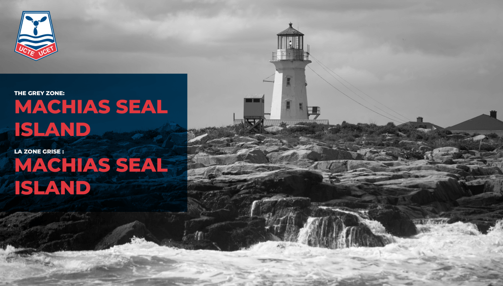
World Maritime Day – The Grey Zone: Machias Seal Island
For World Maritime Day, UCTE decided to tell you the story of a somewhat nebulous area between Canada and the United States. For approximately 250 years, Machias Seal Island has been the source of conflict between the United States and Canada. To give you a better geographical location, this treeless 0.1 square kilometre island is located in the ocean between New Brunswick and Maine. Its value is still unclear. Natural resources are almost nil. Since 1944, it has been considered by the Canadian government to be a sanctuary island as it is inhabited by about 5,800 pairs of birds under the name of breeding puffins. The main reason people visit this area is for lobster fishing; the area is very lucrative for fishermen.
The lighthouse at Machias Seal Island has been inhabited by Canadians since 1832, however, lobster fishermen come from both countries Canada a United State. It is understandable that UCTE Lighthouse Keepers defend Canada sovereignty over the island. UCTE members are on the island and every 28 days a helicopter from the Canadian Coast Guard base in Saint John do a rotation to bring the new lighthouse keeper with supplies for the next cycle. There are 4 main senior lighthouse keepers that change shift every 4 weeks to make sure all the main duties are done. They need to control boat traffic and ensure the navigation conditions are good and safe. It’s an area with a lot of fog so they have horns and equipment to ensure the safety of the people around the island. You need to know that this island is in the middle of nowhere. It is also the only staffed lighthouse now in all Atlantic Canada with the exception of Newfoundland. The people are mostly around for fisheries. They will call our members on Machia Seal Island to make sure everything is safe to start their fishing trip. The main lighthouse keeper on Machia Seal Island has staffed it for around 50 years.
Tension is present even today over the Machias Seal Island claim, which is now dubbed the ‘grey zone’, spanning 72 km (45 mi) between Canada and the United States. The fishing in this area is very competitive, and dangerous for some. As this part of the ocean is not under the control of either country, surveillance is not clear.
In 1984, Canada and the U.S. had similar issues and decisions around other territories. Machia Seal Island was forgotten, and still is today. Kelly, an expert on border disputes, speculates that Machia was left off the table due to the concern that one side would get the island while the other side would get all the lucrative Georges Bank fishery.
Here is a video explaining the importance of this area to fishermen from both countries, also the legend of Tall Barney:
In short, governments will eventually have to make a decision regarding this territory. MacLean’s Magazine took the time to ask, in 2015, what the two countries were doing to actually resolve the conflict. Neither country offered an answer. Unfortunately, even by 2021, we remain in a ‘grey zone’ regarding this territory, but our members make sure this area is safe for everyone.